ACCESS & MOVEMENT
The development features multiple access points designed to enhance connectivity and improve permeability throughout the area, ensuring smooth movement for residents and visitors. Significant improvements will also be made to walking and cycling infrastructure, promoting sustainable travel options. A new signalised Toucan Crossing will provide a safe link between the site and The Rawlett School, while additional crossing points on Coton Lane will facilitate access to existing footpaths and cycleways.
The location offers excellent public transport connections, being conveniently close to bus services and Tamworth railway station. Traffic impact forecasts indicate minimal disruption, with only modest offsite capacity requirements. Traffic flow through the Gungate corridor is projected to remain low, averaging less than one vehicle every two minutes.
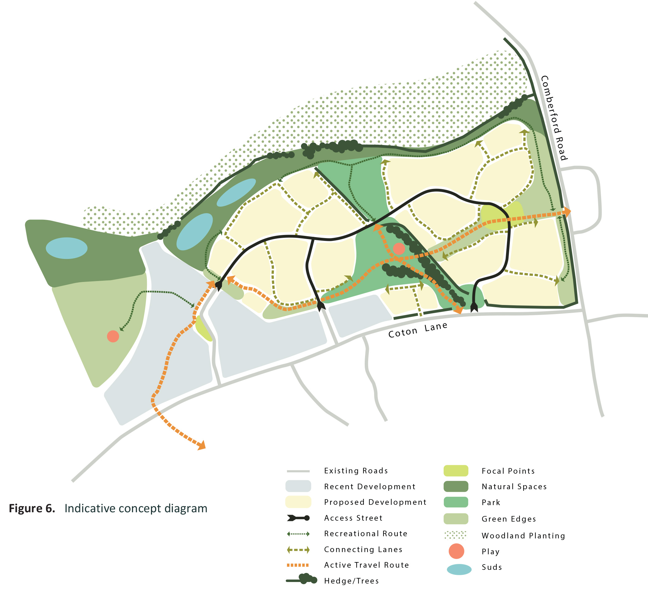
INDICATIVE CONCEPT DIAGRAM